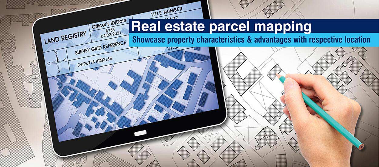
GIS-enabled parcel maps that visually display property data in a relatable form are transforming communication in the real estate industry. They serve as easily accessible, searchable and shareable repositories of property related information for buyers and sellers alike.
Today, the real estate industry is using geographic information systems (GIS) to map parcel and property information in the same way that Google uses GIS for Google Maps. Key difference is that Google Maps carries information of interest to the public, while GIS-enabled parcel maps carry information of relevance to property buyers and investors. Another difference is that the information in GIS-enabled parcel maps is collected, curated, and validated by real estate firms, and not the public.
The USA has about 155 million property parcels and 166,000 neighborhoods. To manage and display this voluminous data, real estate stakeholders are using GIS mapping.
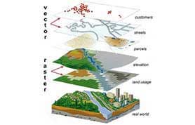
Comprehensive parcel data contains property metadata, such as details of boundaries, ownership information, property document images, and foreclosure information. Neighborhood data includes information like crime rates, schools, home prices, flood risks, pricing trends, fire incidents, etc.
GIS parcel mapping makes it easy to logically attach all this information to properties and plots on the map and access it through a visual and searchable layout.
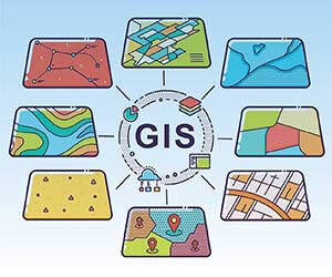
5 Layers of GIS Mapping
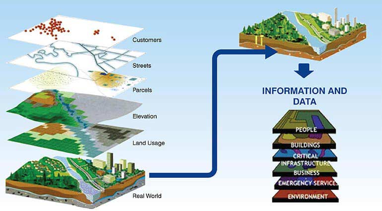
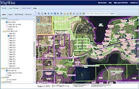
Usually, GIS maps carry five layers of information: address, street, parcel, elevation and zoning. All related information, like schools, hospitals, restaurant locations, rent rates, etc., are represented in relation to these five layers. With GIS maps, multiple filters and images can be added to property search, and all data presented in interactive 3D format.
8 Ways Parcel Mapping Can Change the Game for Real Estate Players
1. Give your buyers a bird’s-eye view of the property
To access accurate data on boundaries, real estate stakeholders rely on GIS-enabled parcel maps. It helps them view parcel data, including size, ownership, APN numbers, tax information, legal descriptions, etc. for countywide properties. Real estate players can share interactive 3D maps coupled with other GIS data to compare knowledge and enrich property profiles.
270,000 property records captured, verified and standardized every month helped US-based real estate information services firm to maintain GIS-ready database for parcel mapping. The property data pool empowers them to give their clients the knowhow about the surroundings of the property they are interested in. It improved customer engagement and experience.
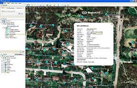
2. Share property maps with buyers
Sharing GIS-enabled property maps with buyers improves conversions and customer experience. They can embed interactive 3D maps of properties on websites. Property listing service providers can embed it on their marketplace website. Images can be rendered from GIS-enabled maps and used as marketing material to engage customers.
Realtors can share parcel map links or frames in emails/messages, enabling buyers to view the property from the comfort of their home/office. Through GIS-enabled maps, property purchasers can view all available properties, with amenities, in any region of a county.
Mapping information from 20,000+ property brochures to property data on the real estate platform, empowered the real estate company to offer geographical mapping of properties to buyers and sellers across the UK. Parcel mapping experts collected relevant information from brochures and located the parcel on the ArcGIS platform to draw the boundary polygons.
Comprehensive solutions to manage parcel data
3. Present properties interactively
Real estate parcel mapping makes the property search process more interactive and easier for home buyers and investors both. Realtors can enter statistics for investors/buyers to filter on information like square footage, project amenities, vacancy status, zoning, etc.
Apart from property specifications, real estate parcel maps can provide virtual tours as well. Clubbing maps with virtual reality allows realtors to offer interactive and 360-degree view of the interiors and exteriors of properties on sale.
With GIS-enabled parcel maps, users can export property data tables or download interactive maps for online presentations. Communication with buyers and investors becomes smoother when all stakeholders can view and discuss property details by sharing a single source of truth.
4. Locating social and physical infrastructure
GIS-enabled parcel mapping helps realtors to assist buyers and investors in identifying urban locations and important landmarks. These landmarks can be public facilities like highways and expressways, commercial buildings like shops, retail stores, offices, or restaurants. By using realistic aerial survey images of a location, realtors can give a comprehensive understanding of amenities on and around a property.
5. Targeted marketing
Real estate parcel mapping helps to gather and examine demographic information, social and physical infrastructure details, and prices. With information on new or existing property development projects, realtors can create ad campaigns to target the right audience. They can import parcel maps into project brochures, official websites and market research reports to make it more interactive. Increased property insights improve targeted marketing, sales and revenue.
A leading real estate data aggregator and market intelligence provider based in USA experienced steep rise in revenue and customer satisfaction graph. Accurate entry of real estate data covering all the US States, categorized as per different counties, type of property and various other attributes helped them attain their business goals.
6. Perform spatial analysis
Buyers and investors want to gather information and understand market dynamics before they invest in a particular property. Spatial analysis evaluates geographical location, demographic data, market potential, and average prices to determine differences and compare neighborhoods.
Real estate parcel mapping uses these data points to keep buyers and investors informed about a property’s details. Buyers can easily grasp the opportunities available, assess differences across sites, and can capitalize on profitable locations. Realtors pass on the benefits to customers interested in upcoming and capital-intensive projects.
7. Evaluating accessibility
At times, businesses have to move or expand, or develop new projects within the same state. Real estate parcel mapping helps them to evaluate property sites based on their accessibility to customers or employees.
For residential, commercial or mixed-use property; developers have to get environmental clearance to ensure that the land does not fall into a disaster-prone zone. GIS-based real estate parcel mapping gathers and provides real-time data for hazard zone mapping, assessing the magnitude of impact, and creating preparedness plans.
Apart from this, GIS-enabled real estate parcel mapping is the key to portfolio management. It gives a comprehensive understanding of a mix of tenants or the impact of investing in mixed-use projects. Real estate firms can pass on the right knowledge and insights to their clients and gain a competitive edge.
8. Examining environment & disaster impact
In residential, commercial or mixed-use property, the developers have to get environmental clearance and be sure that the land is not in a disaster-prone zone. They also have to ensure carbon footprint compliance, and that the construction project doesn’t affect neighboring buildings, facilities or vulnerable eco-systems. GIS-based real estate parcel mapping gathers and provides real-time data for hazard zone mapping, assessing the magnitude of impact, and creating preparedness plans.
Conclusion
Although at the nascent stage, GIS-enabled parcel mapping has tremendous potential for the real estate industry. Real estate parcel mapping services empower agents and brokers with a new way of interaction with customers. It enables consultants and developers to use the information to plan strategies for commercial and industrial property investments. Apart from separating areas according to desired features, GIS mapping can also determine the livability of a location. Since every realtor believes in “location, location, location,” GIS-enabled parcel mapping has all the information they seek to make smart and profitable decisions.